Where we are
The Refuge is located at the foot of the Marguareis, near the Colle dei Signori, High Tanaro Valley, in the municipality of Briga Alta (CN).
Getting there
Due to its special geographical position in which it is located, the refuge Don Barbera can be reached from 5 main access streets, positioned in a radial way: Carnino (Tanaro Valley), Limone Piemonte (Vermegnana valley), Tenda (val Roja), Chiusa Pesio (Pesio valley), Rastello (Ellero valley). This allows a wide variety of hiking, walking and links from multiple starting points.
Main access: Carnino valley
Road access
From Torino-Savona motorway exit at Ceva, then climb the Tanaro Valley to Ponte di Nava, where you take the right crossroad for Viozene, Carnino and Upega. Before the bridge over the Rio Carnino is the detour for Carnino. In Carnino Superiore (Superior Carnino) you leave the car (parking).
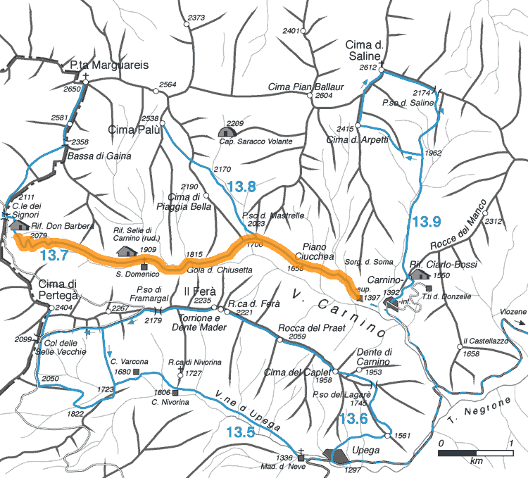
The main path
Access on foot from the village of Upper Carnino take the trail marked as A3, and that goes to the west. After the floor Ciucchea at an altitude of 1656m we meet the road for the passage of Mastrelle. Continuing to the right on the path A3 is going to overcome the narrow gorge of the Chiusetta to emerge on a large plateau of the plan of Chiusetta. After meeting with the church of San Domenico there stands in the valley of the Masters and finally reach the large Colle dei Signori. A few tens of meters below the hill lies the Refuge Don Barbera.
From Strada Militare Limone-Monesi
Having a off-road vehicle, Colle dei Signori can be reached from Monesi (the head of Val Tanaro) or the Colle di Tenda (the head of Val Vermenagna) with a bold and exciting street ex-military.